 Natural Heritage Monuments
Sauiskandyk is on the north-eastern slopes of Karatau in the Shielin District of the Kyzylorda Region, 60km East of Shieli, 15km north of Aksumbe Village. Research Status and Documentation.
Rock art images at Sauiskandyk were discovered in 2004 by an expedition from a Turkish-Kazakh University (Turkestan town) led by Yeleunova M. They were researched and recorded under the leadership of Samashev Z.
(Institute of Archeology of SAS of the RK), in partnership with Shvetz I.N. In 2008 - 2009, Rogozhinskiy A.E. studied both petroglyphs and epigraphy. Sauiskandyk is the northern most location of the Sauiskandyk Valley is about 3km long; two Bronze and Middle Ages dwelling sites were identified in the upper reaches of the valley.
The main concentrations of petroglyphs are located on the right bank of the valley and along the riverbeds on shale and sandstone outcrops, with a total of more than 3000 images. Bronze Age petroglyphs show artistic expressivity and a diverse repertoire.
Two series of drawings stand out. The first one includes images of animals (bulls, horses, and predators) and humans (warriors with clubs, women, erotic scenes, composite creatures) that significantly differ stylistically from other known Karatau Bronze Age petroglyphs.
Images from this group prevail in the middle and lower parts of the valley. The second group includes engravings concentrated in the upper part of the valley near dwelling sites. Images of horses with a pronounced mane are dominant; there are many scenes with camels, humans and signs in the shape of a right-angled cross. Stylistically, these petroglyphs are comparable to the second Arpauzen type and to many others in Central Kazakhstan and date to the middle of the IInd millennium BC.
Late Bronze Age petroglyphs are small in number, with bulls, horses, and chariots. Early Iron Age drawings, with expressive scenes with naturalistic animals and compositions with humans, are not numerous.
There are very few medieval petroglyphs, but they also include quite expressive compositions: covered wheeled wagons on wheels with spokes surrounded with riders, camels; a yurt with female and male figures inside; a scene of battle between two riders; tamgas.
A large series of Arabic inscriptions (about 40) and tamgas of different types, dating to the XVIIth – early XXth centuries, were mainly found on rocks along the trail running through the bottom of the gorge.
There are also images of rifles on bipods and Kazakh tamgas dated to the XVIIth - XVIIIth centuries. A large number of texts of apparently religious and memorial content are related to the functioning of a transit caravan road that passed through Sauiskandyk Gorge in the northern part of Karatau.
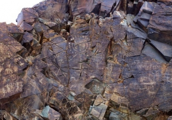
Set around the lush Tamgaly Gorge, amidst the vast, arid Chu-Ili mountains, is a remarkable concentration of some 5,000 petroglyphs (rock carvings) dating from the second half of the second millennium BC to the beginning of the 20th century.
Saryarka - Steppe and Lakes of Northern Kazakhstan comprises two protected areas: Naurzum State Nature Reserve and Korgalzhyn State Nature Reserve totalling 450,344 ha.
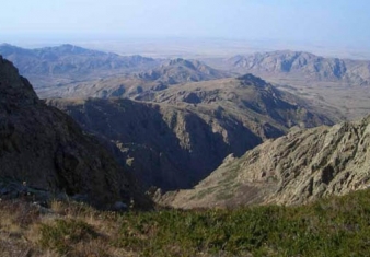
The cultural landscape of Ulytau is situated in the semi-desertic zone of Central Kazakhstan and it shows all its typical natural features: low mountains, conical-shaped hills, plains, river valleys and lakes.
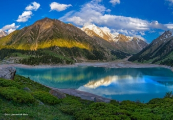
The natural object of nomination is located on the northern macrohillside of the ridge Trans-Ili Ala-Tau, which is the part of Northern Tyan Shan physical geographic province (Gvozdetskiy, Nikolaev, 1971).
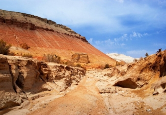
Altyn-Emel State National Nature Park is sprawled in the heart of Central Asia, in the valley of the Ili River, about 150 kilometers away from Almaty, Kazakhstan’s largest city.
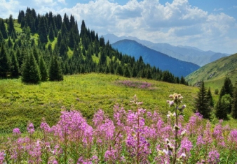
The Aksu-Zhabagly Nature Reserve is the oldest nature reserve in Central Asia. It is located in the southern province of the Republic of Kazakhstan.


