


Reviews
0 / 0 reviews
 Natural Heritage Monuments

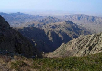
The natural object of nomination is located on the northern macrohillside of the ridge Trans-Ili Ala-Tau, which is the part of Northern Tyan Shan physical geographic province (Gvozdetskiy, Nikolaev, 1971). Relief. The ridge of Trans-Ili Ala-Tau is complex and by its topology relates to the northern spur of Tyan Shan.
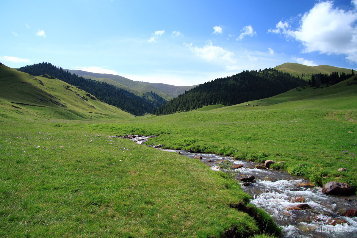
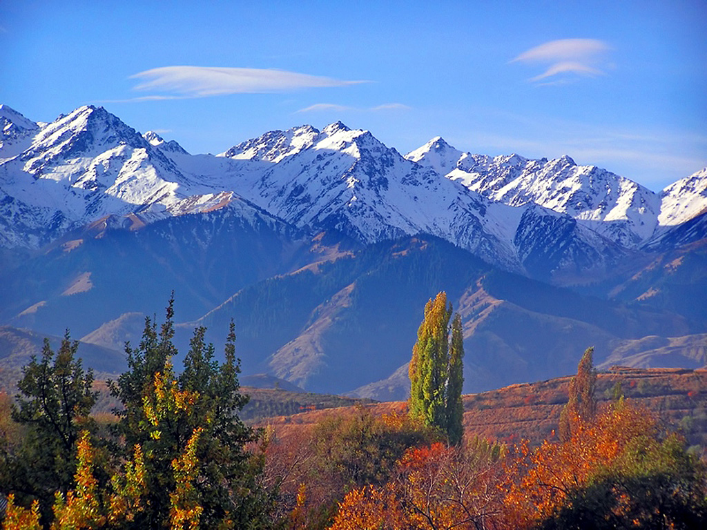
The territory is peculiar of vertical zonality or belt character of relief, that specified a wide variety of landscapes. The high-mountainous (upper) nival glacial chord encompassing paraxial part of the ridge, occupies altitudes of 3000 m above sea level.
This band is of "alpine" character, with sharp tops, steep stony declines. Northern and southern slopes of the ridge abound of incuts of glacier kars, semicircular circuses, with a diameter of several hundred meters. It is the main place of formation of glaciers. Their tongues are penetrating into spur valleys of the head rivers.
The largest glaciers have length of up to 6 kms and area of up to 18 sq. kms. At the whole northern macroslope of Trans-Ili Ala-Tau there are more than 300 glaciers, total area of which more than 300 sq. kms. The glaciers are frequently surrounded with a border of massive clumpy moraines, which are tending down the valleys down to the altitude of 2 750 m.
Below chord of modern glaciation stages of connate kars, of slope valleys are seen, as well as "lenses" of a permafrost (basin of the river Turgen). The erosive relief of middle part of mountains occupies absolute altitudes in a range of 1700 up to 3000 m. The gorges and narrow valleys with the depth up to 700 m. with steep slopes are most typical here: (up to 400).
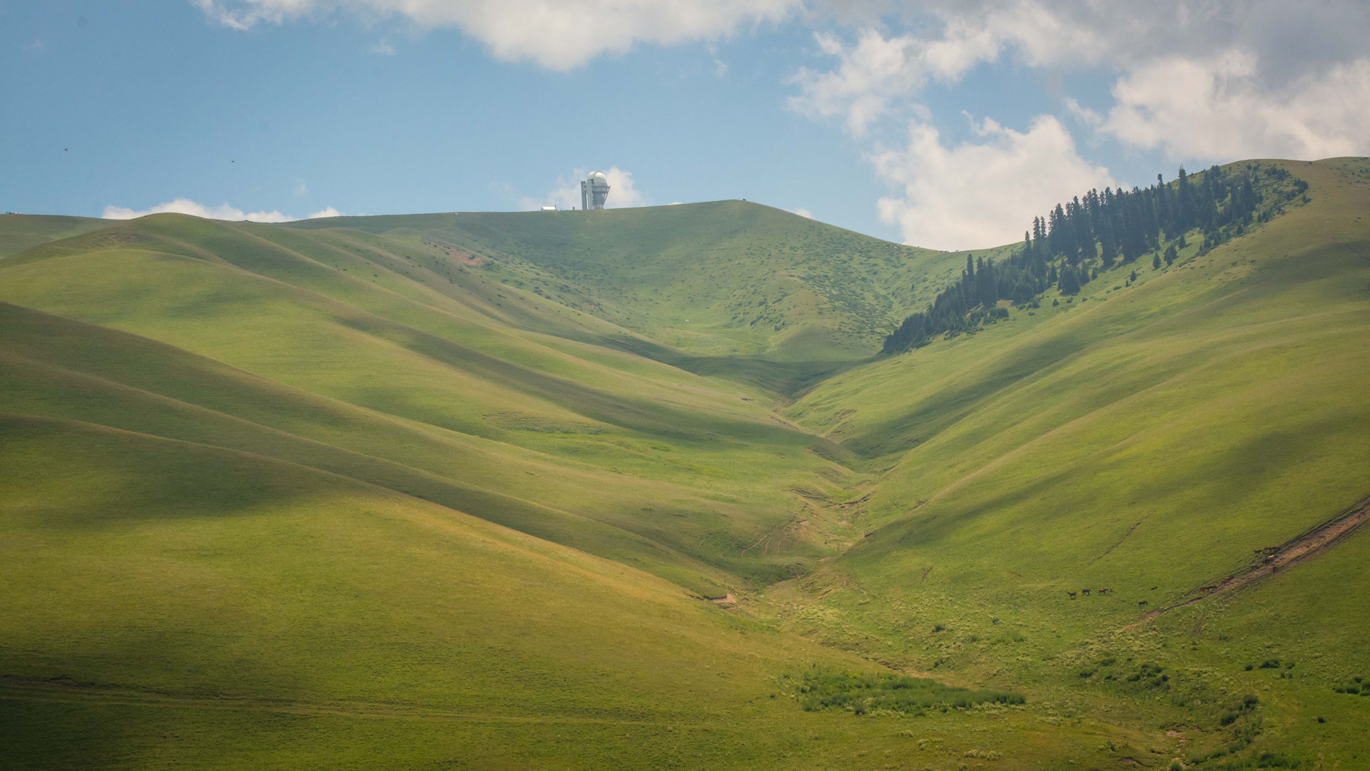
The relief of the given chord is notable for intensive by slope processes: talus, downfalls and stonefalls. While ridges on watersheds in meridional directions are more weak and rounded. The relief is low-stepping, it occupies a band in a range 1100 – 1700 m. Geomorphological aspect is represented by the ridge and ridge stony parts with wide, with smoothed watersheds and deep erosive incuts.
The slopes have angle of inclination up to 300 and more, while that watersheds – 5-100 Main part of the stage is located outside of national park, however whole set of features, including effects of the sliding phenomena of seismic nature, it is possible to observe from the northern side. In general the territory is the young mountain land, which is notable for catastrophic cyclic natural processes – earthquake, mudflows, and snow avalanches.
Climate
By climatic features the territory relates to Trans-Ili subregion, which is notable for moderately warm climate with a late spring-summer maximum of sediments. The vertical zonality of the climatic features is vividly expressed.
Their most appreciable displays are inconvertible temperature drop and magnification of intensity of solar irradiation, annual and seasonal volume of atmospheric precipitation in accordance with magnification of terrain clearance altitude. Endurance of solar light is above 2000 hours per year. The mountain band of middle altitude is notable for gentle winds (1,5-2 m/s). During short-term periods of time in low and high-mountainous zones the speed of wind may exceed 20 m/s.
In winter the inverse of temperature of air diffusing up to the altitude of 2000 m has place. At the altitude of 800 m the mean temperature of January is – 6.80, at the altitude 1529 m is -3,70, and at the altitude of 1942 m is 6.30. The summer in low altitude part is long-term and hot. Mean temperature of July is 20-220.
As altitude increases the summer becomes shorter and more cool. In the middle altitude part mean temperature of July is 10-150, and in high-mountainous part is 5-100. The volume of sediments with altitude is being increased: from 616 mm (at the altitude of 800 m) up to 1000 mm (3500 m). With altitude endurance of conservation of snow overlying strata and its altitude also is increased.
In a low part the snow is laying 190 days, and its altitude in the spring reaches 100 m. In high-mountainous bands the snow lays more than 250 days, and its altitude exceeds 100 m. (Atlas of Kazakh SSR, 1982) Hydrography. Features of natural climatic conditions specify forming of intensive surface sink and advanced hydroplot network.
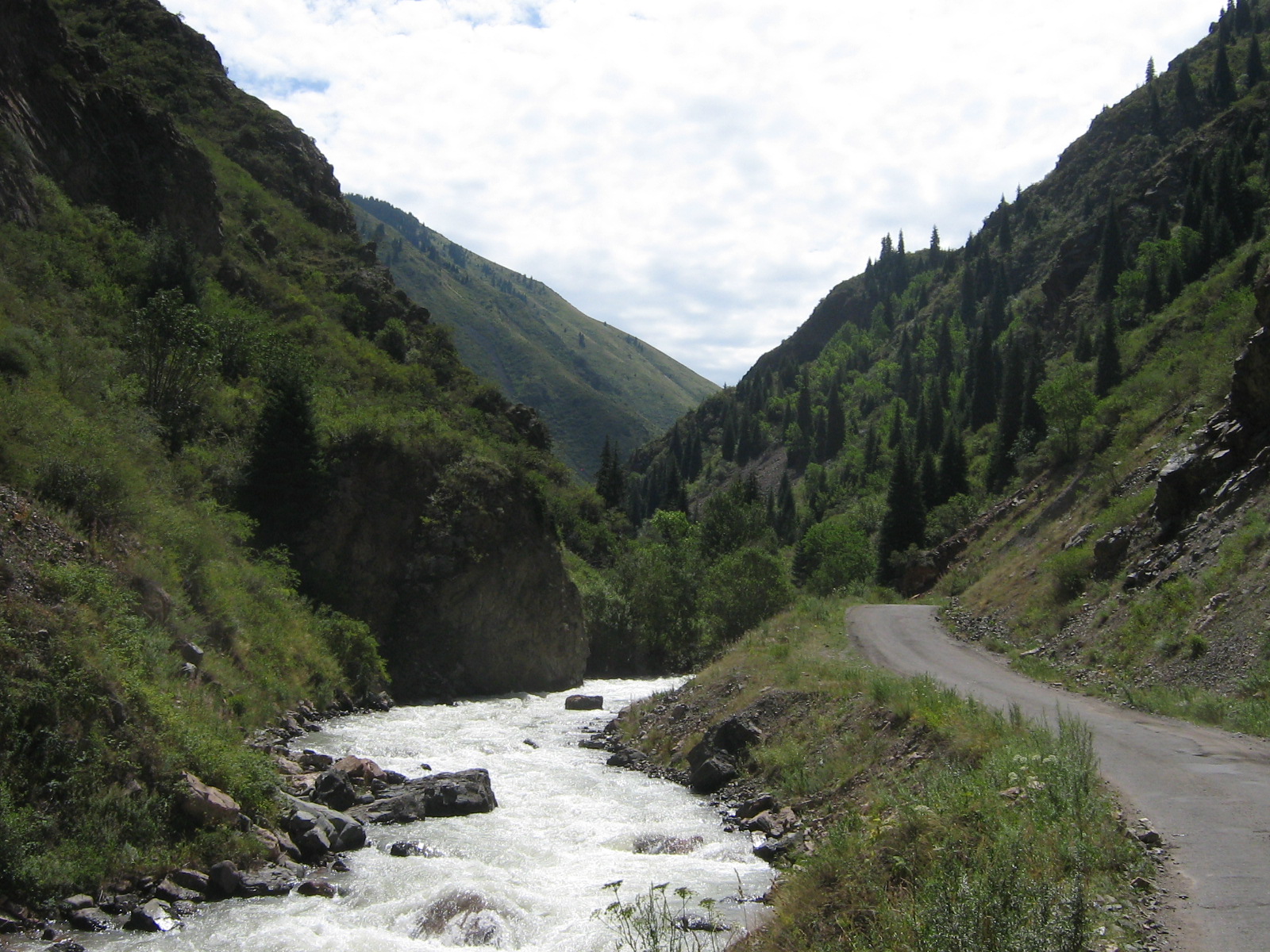
By nature of feeding and drains all rivers of Trans-Ili are subdivided into three types: high-altitude glacial, middle-altitude and low-altitude. The largest are the rivers of the first type. Among them are (west-to-east) the rivers Chemolgan, Kaskelen, Aksai, Major and Minor Almatinka, Talgar, Esik, Turgen. It is the rivers of glacial feeding, which are deep and have great area of water collection.
High standing of water in these rivers has place for a long time - from the beginning of thaw of snows (in April) up to the end of August. The depth of their valleys reaches 800-1000 m. Maximum average annual rates of stream are observed scored at the rivers of Talgar –10.3 cub. m./year, Turgen – 7.04 cub. m. / year, Esik – 4.99 cub. m./ year.
Middle-altitude rivers, the sources of which are located at the altitude of less than 3000 m., are fed mainly by atmospheric precipitation and underground waters. In most cases they take originating from springs getting out of tectonic faults and fractures of bedrocks. Most of them are small (15-20 km) highland rivers with high inclination of channel and rapid stream.
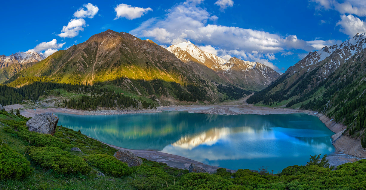
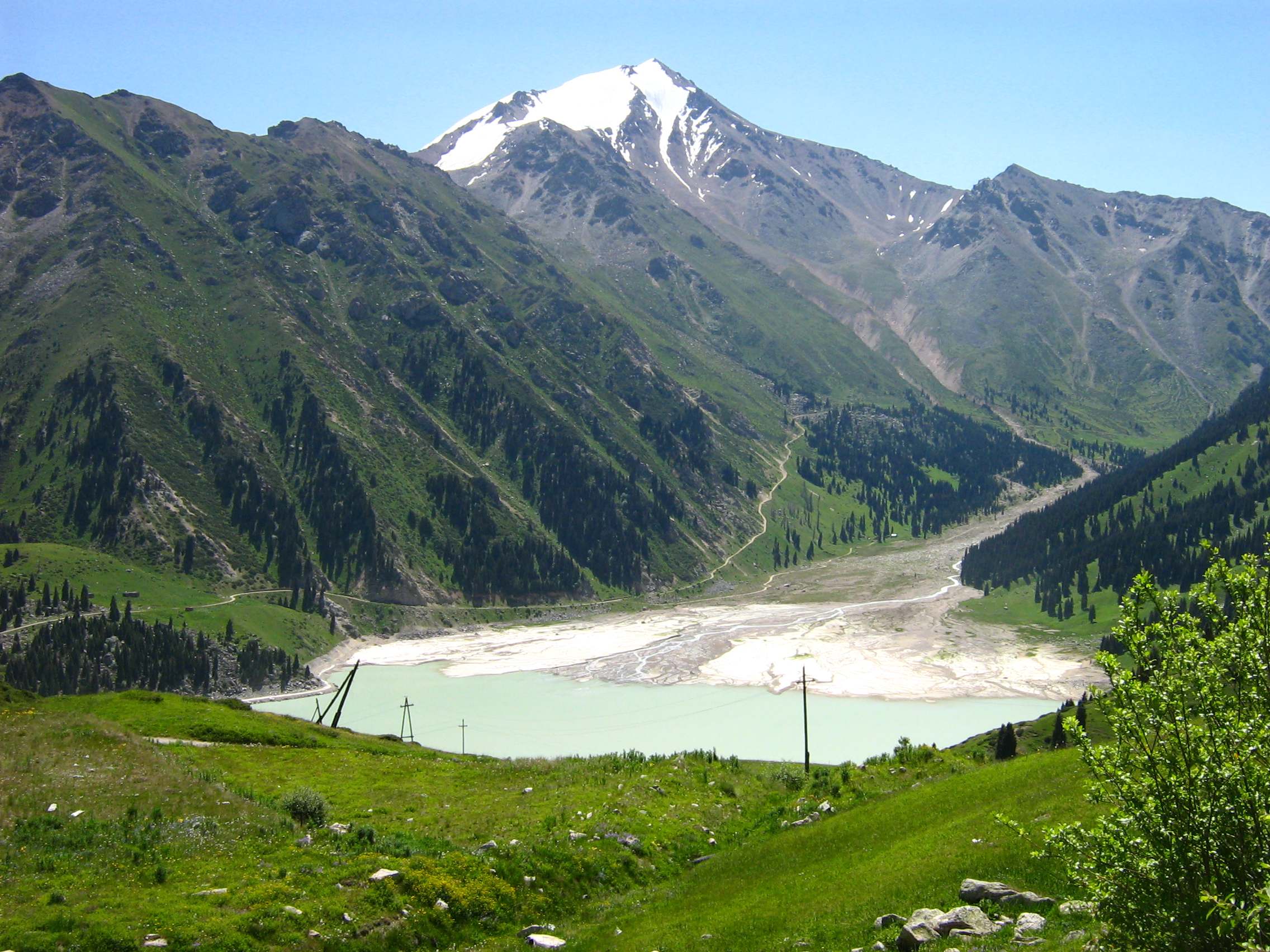
The third type includes many originating in low-altitude band of the ridge of the shallow seasonal rivers, in which water appears only in spring, and in summer they dry up. There is a number of lakes of various sizes in the territory. By origin and aqueous mode there are the following types of lakes: glacial, starved, starved retaining and landslip tectonic.
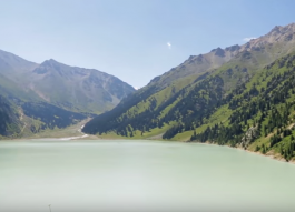
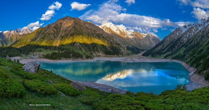
The sizes of them are changing from 100-200 m in a diameter up to 1-1,5 km. To the latter type the lakes of landslip tectonic origin are related – Esik and Major Almaty lake. Landslip dam of the former one had been destroyed during intense mudflow of 1963. The breaking have barred later artificially and again formed lake has considerably smaller area.
Level of the second lake is artificially uplifted up by a dam, and it is a potable water storage for Almaty, thus, the territory which is included in national park is a place of forming of the aqueous drain providing water supply of settlements and agricultural zone of piedmonts.
Soils
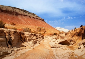
In the territory of the object all the range of mountain soils formed under influence of vertical zonality is represented. Highland is occupied by the Mountain Alpine and sub Alpine soils with the breadth of humus horizons from 50 cms and less.
The mechanical composition includes mean and high-gravity loams, completely free from carbonates with intense stoniness. The high-mountainous meadow and steppe soils with brown and hazel coloring with the content of humus up to 15 % and low-current profile are characteristic for more low levels. Mountain wood dark color soils are formed in extremely split average-level relief of humidified northern slopes at the altitudes from 1600 up to 2500 m. in fir-woods.
Soils of carbonates with high content of humus of the upper horizon (up to 15 %) have acidic and weak acid reacting. Mountain steppe thermal xerophyte soils are laid on steep, rubble slopes of southern and western exposures, frequently in a combination with mountain chernozem. They are weak, highly rubbish, and non-rubbish loams mainly of eluvial and deluvial genesis.
The low breadth of profile and low (up to 5 %) content of humus is typical. In submontane band are abundant with the content of humus up to 15 %. The communal power of humus horizon (And + ?) reaches(achieves) 120 cms On bulk and grain composition the profiles are more often uniform. Flora and vegetation.
By degree of taxonomic variety the flora of the object, may representatively introduce all the Northern Tyan Shan. Thus the high level of a bipolarity is explained by a non-uniform biological situation. The location of Trans-Ili Ala-Tau at the turn of Dzhungar Tyan Shan mountain and mountain Central Asian provinces. Reliable amount of classes till now is not known.
According to the scientists of Institute of Botany and Phyto-production Ministry of Education and Science of RK there are more than 1200 classes only of higher plants. The wood classes alongside with a fur-tree of Schrenk are represented by maple Acer semenovii, aspen Populus tremula, apricot Armeniaca vulgaris. Bushes - hawthorn Crataecus aliaica, Tyan Shan mountain ash Sorbis tianschanica, barberry Barboris heteropoda, dogrose Rosa alberti, Grassy - Aegopodium alpestre, Geranium Collinum, Brachypodium pinnatum, Cicerrbita cizurea, mosses Polythrichum juniperinum and other.
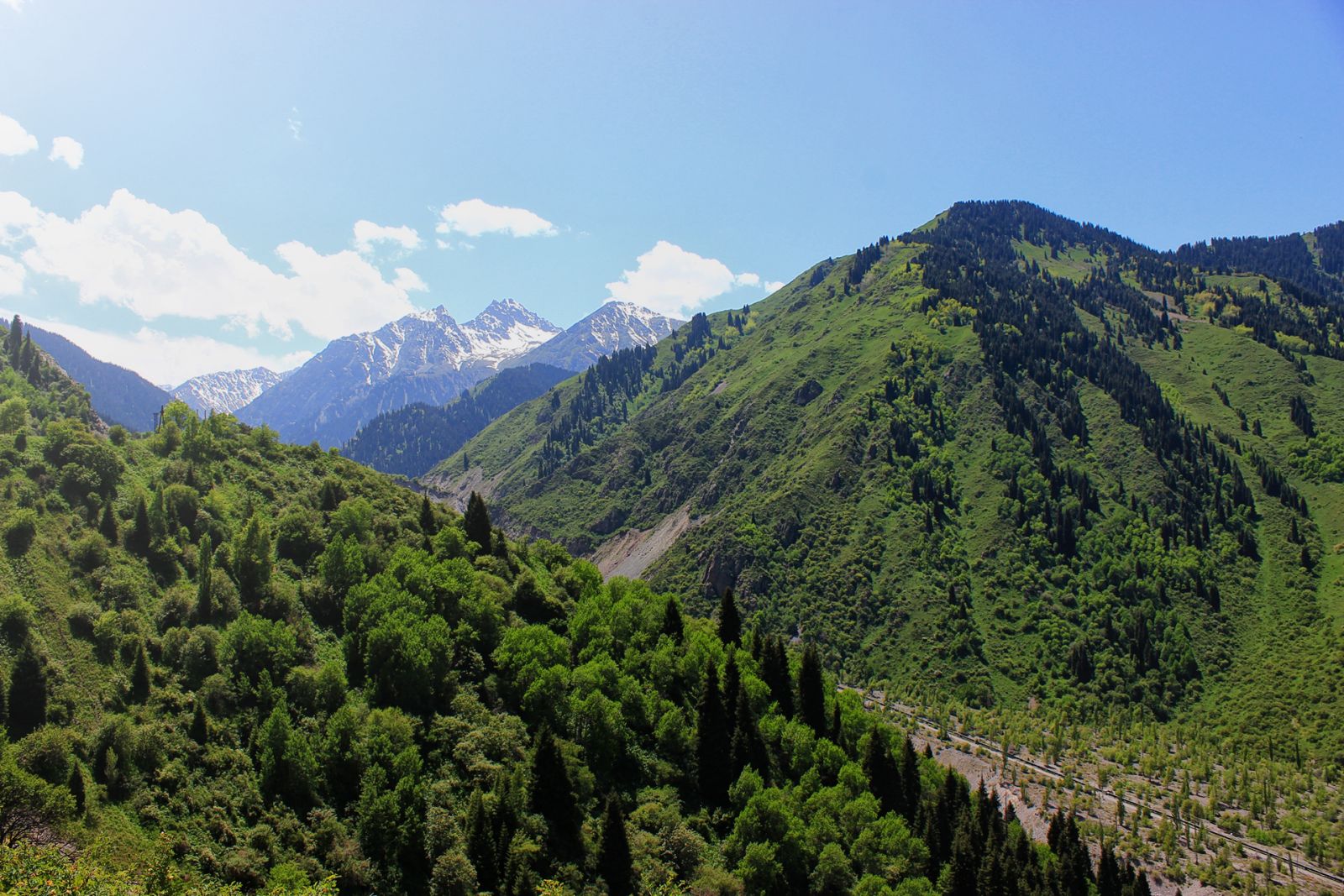
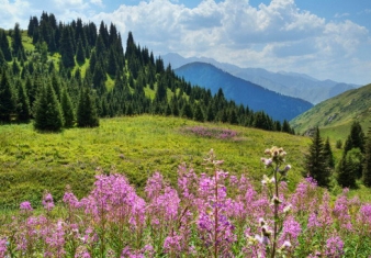
The vertical zone chords are notable for their type of vegetation. The vegetation of southern and northern exposures also differ. Nival and subnival chords from 3400 m up to 3600 m are characterized by absence of close vegetative overlying strata. On southern slopes cryophitic sibaldia are diffusely abundant.
In Alpine chord (2800-3400 m) the basic type of vegetation – criophyte meadows, sometime pines, and also original high-mountainous sedge bogs. The subAlpine chord (2400-3000 m) is characterized by dominance of such type of vegetation – middle grass criopryte meadows and steppe with the bushes of junipers on southern stony slopes. Cereal, rich with grasses meadows, cuff meadows are dominating. Criophyte steppe are mainly represented in eastern and western regions of the object.
Bush-meadow-coniferous forest chord (1600-2800 m) has a composite vegetative overlying strata. Northern slopes are occupied by fur-trees of Schrenk, while southern – by bushes of dogrose - rosary. Also there are aspen forests, and sometimes birch woods. Most of areas are occupied by mesophilic meadows of cereal and multi-grasses cereal communities.
Bushes and small-leaved wood chord (1400-1600 m) is located in a central part of the object in a submontane part, so-called "counters". This chord had been impacted by antropogenic factor, which had changed a tentative vegetative overlying strata. The groves of Siverse apple-tree and apricot are remained. On southern slopes rosaries are widely spread. The grassy overlying strata includes mesophylic meadow grasses and various grasses, and on southern slopes there are steppe cereals. It is the zone of plant cultivation, which is also affected by recreational impact.
On the nominated territory there are 46 classes of seldom and endemic kinds of plants. Among them growing at the low level Tulipa Ostrowskiana et T.Kolpakowskiana, Iris Albertii, Iridodictium Kolpakowskianum, Altay Gumnospermium altaicum, at the middle level – Erysimum croceum, Corydalis semenovii, Oxytropis almgatensis, Cortusa semenovii, Rheum wittrocki, at high altitudes - Hepatica falconeri, Sibiraea tfanschanica, Schmalhausenia. Nidulans etc.
Fauna
The variety of spectrum of natural ecological systems of Northern Tyan Shan specifies an appreciable variety of taxonomic classes of animals. The region is notable for plenty of northern wood, and, steppe and desert classes, that specifies its high extent of biological variety (Bekenov, 1991). In general 8 classes of fishes is registered (8 % of ichtyo-fauna of Kazakhstan), 2 classes of amphibians, 10 classes of reptiles (respectively 16 % of fauna), 148 classes of nesting birds (27 %) and 47 classes of mammals (27 % of teryofauna of the Republic), invertebrate animals are also numerous, the number of classes of which is not established yet. Fauna includes dozens of classes that are rare and endagered, and also of aesthetic value.
Invertebrate animals of the region include both typical wood classes, and classes, peculiar to zone complexes – steppe, half-deserted and deserted classes. The population of intra-zonal biotopes (flood-plain and aqueous) notable fora variety of views. Fauna of most studied class of Insects includes no less than 1500 species, that compounds about 50 % of species variety. Rare species of rhopalocera lepidopterous are of special importance. Among them are Papilio machaon, Erabia sibo, Iphiclides podalirius, Neolycaena ekweilleri, Parnassius patricius, etc.
Mainly these species are high-mountainous, living locally (Zhdanko, 1997). Birds. In the territory of Northern Tien Shan more than 27 % of nested ornis of republic is registered. It is 148 species of birds which are included into 14 groups and 411 families. Among them 22 species live only on piedmonts and in cultural landscape. Fauna of opened (low-altitude) landscapes is represented by Sylvia communis, Phylloscopus trochioides, Ph. Momatus. The fur-tree woods are inhabited by Serinus pusillus, Erythrina erythrina, Regulus regulus, Cuculus canorus, Nucifmga caryocatactes, blackcock Lyrurus tetrix. Sub-Alpine and alpine zone is occupied mainly by leucosticte nemoricola, Prunella alpica and P. humalaensis, Anthus spinoletta, Pyrrhocorax graculus.
Among rare and disappearing species there are 13 species: Ciconia nigra, Ibidorhyncha struthersii, Hieraaetus pennatus, Aqwia chrysaetos, Gypaetus barbatus, Gyps humalaensis, Faico columbarius, F. Cherrug, F. Peregrinoides, Myophonus caeruleus, Leptopoecile sophiae and Caprodacus major, that compounds about a quarter of all species included into the Red book of Republic of Kazakhstan. It is necessary to point out, that the region is main territory of nesting of all mentioned big predatory birds, which at a global level are threatened by disappearance.
Mammals
the nominated region includes about 27 % of species of the whole teriofauna of Kazakhstan. Fauna includes representatives of groups of rodents, predatory, Cheiroptera, insectivorous, ungulate, hares and more than 50 % of families of Mammalia, habiting the territory of republic. For high altitude the species peculiar for Central Asia – Marmota baibacma, Capra sibirica, Ovis ammon – are most typical, including endemics of Tyan Shan – Ochotona rutila and Sicista tianschanica.
In fauna of wood-meadow-steppe chord the appreciable role is played by northern boreal classes – Tyan Shan and small Sore asper and S. Minirtus, Tyan Shan wood field-vole Clethrionomisfrater. An important role in biocenosis is played by such large mammals as Cesryus elaphus, Capreolus capreolus, and also by many species of predatory and Cheiroptera.
Rare and disappearing classes included into the Red book of Republic of Kazakhstan 9 views include Cuon alpinus, Tyan Shan Brown bear Ursus arctos isabeilinus, porcupine Hystrix indica, stone marten Martes foina, Central Asian otter Lutra lutra, Felis manul, Turkestan lynx Felis lynx isabellinus, snow leopard Uncia uncia, Ovis ammon.
Historical-cultural monuments
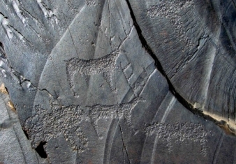
On the nominated and neighboring territories there are archeological monuments of different epochs. Among them are 3 sites of petroglyphs, 10 burial mounds of early iron epoch, 4 settlements of early iron epoch and 2 medieval sites of setlements. Distinctive feature of region are so-called "imperial" burial mounds of east scythians – saki-tigrahounds, and also the oddments of medieval cities and settlements, which existed along the Great Silky Way, historically connecting cultures of East and West.
Recreation and tourism. One of the basic problems of Ile-AlaTau state national park is recreation and tourism activity. For these purposes special sites are allocated, which are under recreational accomplishment. 170 places for picnic, in a summer time 2-3 yurts and tents camping’s are working, historical and ethnographic visit-center Kieli-Bulak is under construction.
There are 22 tourist routs and 5 ecological tracks. In 2000 in the national park 140000 people spent time. 69 organized tourist groups – 3450 people were accepted. More than 5000 copies of the booklets, notes for the tourists attending national park are issued.
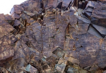
Set around the lush Tamgaly Gorge, amidst the vast, arid Chu-Ili mountains, is a remarkable concentration of some 5,000 petroglyphs (rock carvings) dating from the second half of the second millennium BC to the beginning of the 20th century.
Saryarka - Steppe and Lakes of Northern Kazakhstan comprises two protected areas: Naurzum State Nature Reserve and Korgalzhyn State Nature Reserve totalling 450,344 ha.
The cultural landscape of Ulytau is situated in the semi-desertic zone of Central Kazakhstan and it shows all its typical natural features: low mountains, conical-shaped hills, plains, river valleys and lakes.
Altyn-Emel State National Nature Park is sprawled in the heart of Central Asia, in the valley of the Ili River, about 150 kilometers away from Almaty, Kazakhstan’s largest city.
The Aksu-Zhabagly Nature Reserve is the oldest nature reserve in Central Asia. It is located in the southern province of the Republic of Kazakhstan.
Sauiskandyk is on the north-eastern slopes of Karatau in the Shielin District of the Kyzylorda Region, 60km East of Shieli, 15km north of Aksumbe Village. Research Status and Documentation.


